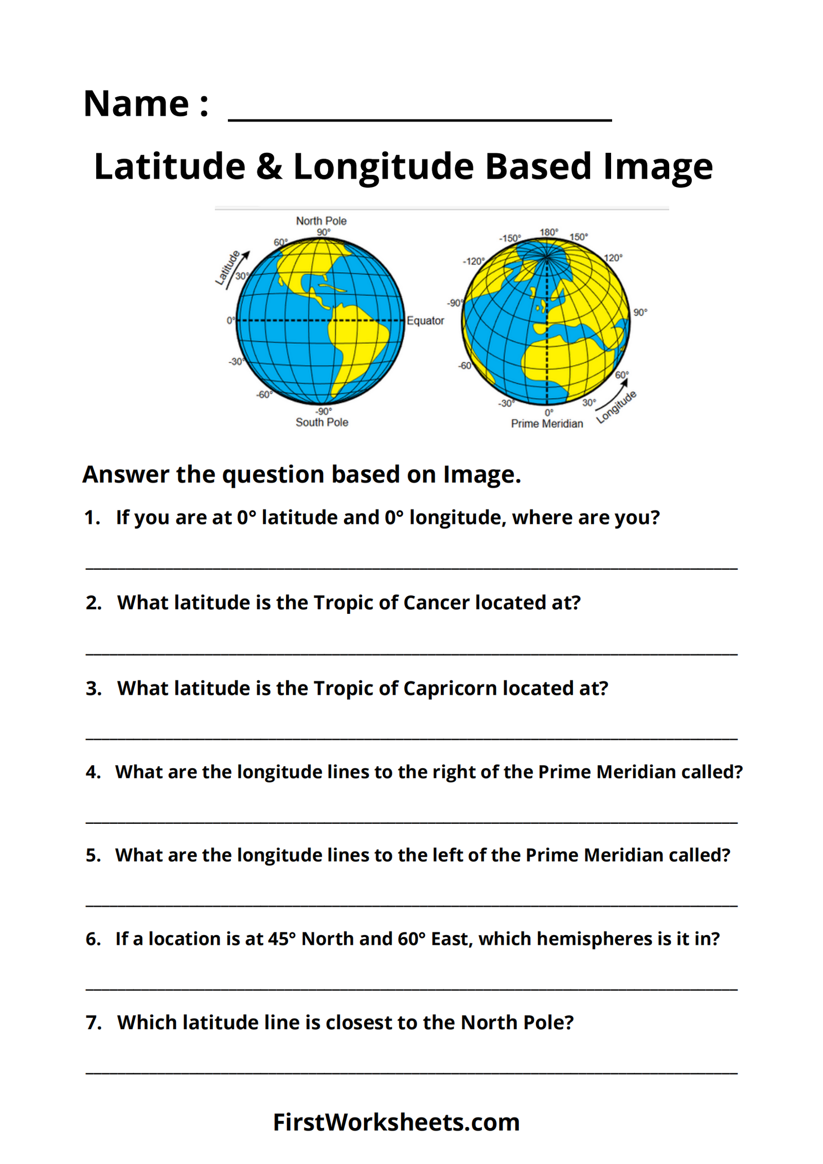
This worksheet focuses on understanding latitude and longitude, which are the geographic coordinates used to pinpoint locations on Earth. The worksheet includes an image of a world map with latitude and longitude lines marked.
The purpose of this worksheet is to:
- Reinforce understanding of latitude and longitude: Students are asked to identify key lines like the Equator, Prime Meridian, Tropics of Cancer and Capricorn, and understand the directions (North/South for latitude, East/West for longitude).
- Practice reading coordinates: Questions require students to determine locations based on given coordinates, helping them understand how these coordinates work together.
- Familiarize students with hemispheres: By asking about locations in relation to the Equator and Prime Meridian, the worksheet helps students understand the concept of the Northern/Southern and Eastern/Western hemispheres.
This worksheet is a valuable tool for teaching students the fundamentals of geographic coordinates and their role in identifying locations on Earth.

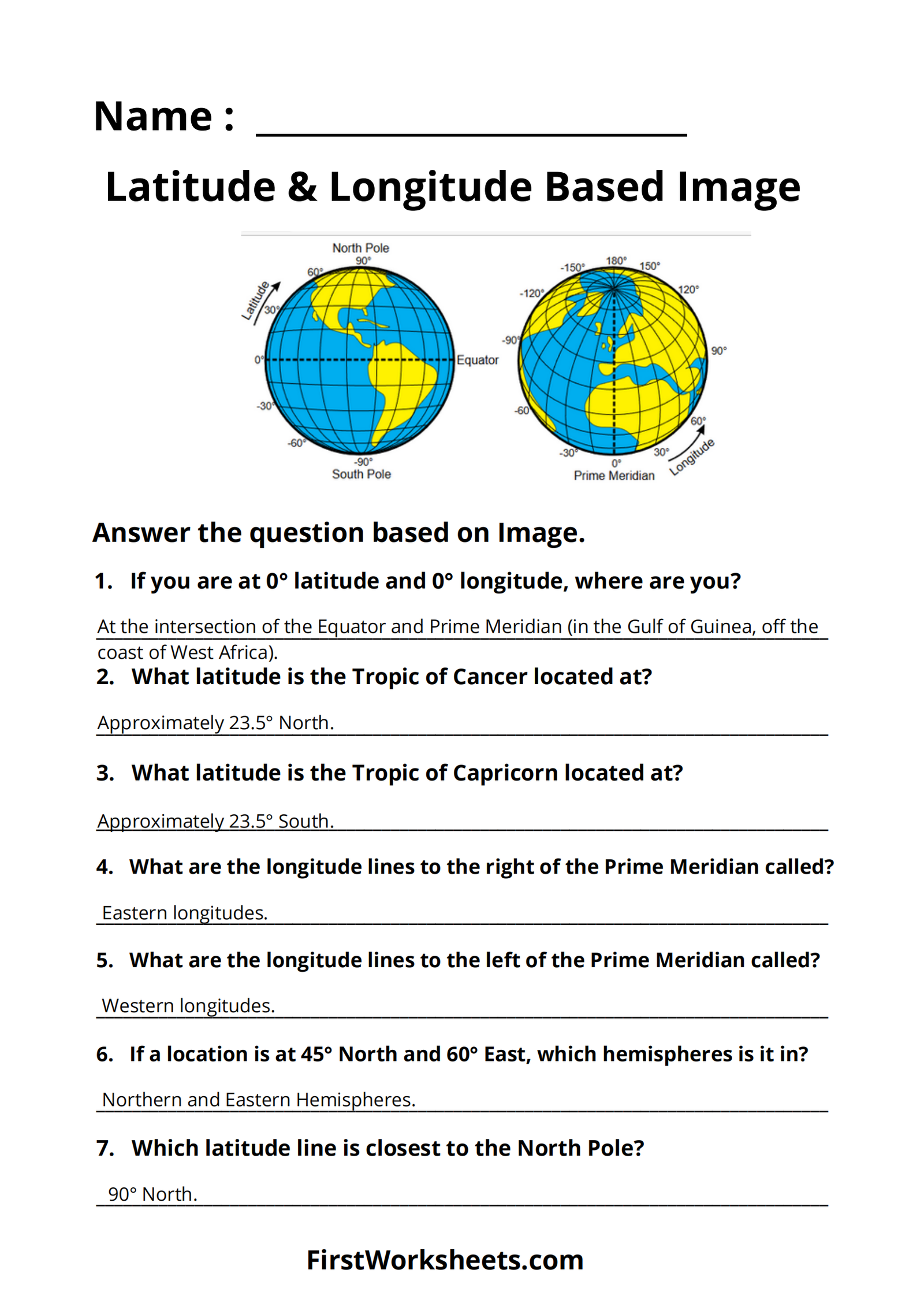
Answer Key
